
By visiting our site, you agree to our privacy policy regarding cookies, anonymous tracking statistics
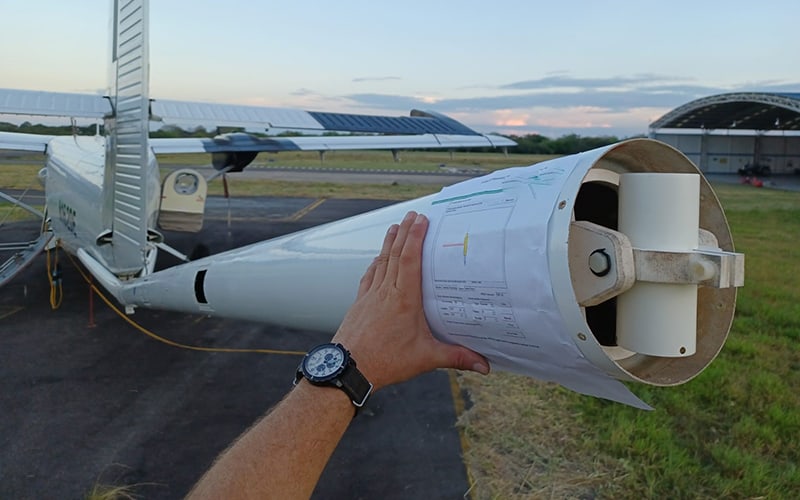
Airborne magnetic surveying is a cost-effective technique for measuring the strength of the Earth’s magnetic field. This is because large areas can be covered rapidly and with minimal errors.
The magnetic susceptibility of rocks is linked to the quantity of magnetic accessory minerals they harbour, including iron-bearing minerals like magnetite, hematite, and pyrrhotite.
A magnetic survey is used in resource exploration to help identify mineral-bearing ore bodies or oil-bearing sedimentary structures below the surface of the Earth. This is done by measuring the magnetic field intensity over a given exploration area.
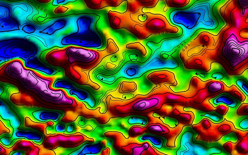
Using the data collected from the magnetic survey, magnetic-intensity profiles and maps of the target area are created.

Information gathered from magnetic surveys is used for large-scale geological mapping or detecting objects buried underground.
For mining, a magnetic map generated from magnetic surveys can help locate mineral deposits by identifying specific rock types and geological features.
For oil and gas, magnetic maps can help accurately define depth to basement, basement property changes and the presence of basinal areas and volcanics.
Results from high-resolution magnetic surveys can provide information on faulting and bedding in non-volcanic sedimentary areas, where mineralisation along subsurface boundaries can produce a subtle magnetic signature, measurable from the air.
Magnetic datasets have additional applications in hazard detection (natural/UXO), windfarm infrastructure planning and geothermal heat flow mapping.
Magnetic surveys are commonly conducted from the air and are usually referred to as Aeromagnetic surveys. They can also be conducted on the ground with a device called a magnetometer.
The interpretation of magnetic measurements concentrates on the identification of geologic units, which are identified in areas with a distinctive magnetic signature (i.e., magnitude, shape, texture, and trend).
Volcanic intrusions such as sills, dykes, and lava flows carry accessory magnetite.
Additionally, magnetic surveys can be successfully utilised to accurately demarcate the location of dykes in coalfields.
At Metatek, we not only conduct all magnetic surveying to the highest level of quality and accuracy, but we also process your data so that it is presented in an easy-to-understand format for you.
Find out more about our data processing here.
Contact us to discuss your project today.