
WHAT ARE THE FUNDAMENTALS OF LIDAR TECHNOLOGY IN GEOPHYSICS?
What are the Fundamentals of LiDAR Technology in Geophysics? As exploration projects increasingly move into complex or remote environments, the demand for accurate and high-resolution

What are the Fundamentals of LiDAR Technology in Geophysics? As exploration projects increasingly move into complex or remote environments, the demand for accurate and high-resolution
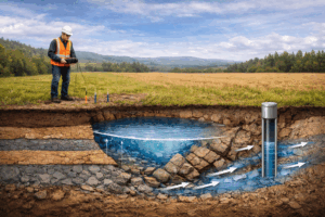
How Are Geophysical Surveys Used For Groundwater Exploration? Groundwater exploration plays a critical role in securing reliable water supplies for domestic, agricultural, industrial and environmental
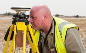
What is Geophysics Used For? Geophysics plays a central role in enabling us to understand the Earth’s subsurface. It allows geoscientists to measure variations in
What is Ground Engineering? Ground engineering is a specialist field that focuses on understanding and managing the physical behaviour of the Earth’s subsurface to support
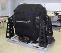
What is FTG in Geophysics? In geophysics, FTG stands for Full Tensor Gravity Gradiometry which is a method of measuring the changes in the density

Examples of Gravity Survey Methods Gravity surveys are a well-established geophysical technique used to investigate variations in the Earth’s subsurface. By detecting subtle changes in
What is Gravity Gradiometry? A Guide from the Experts Gravity gradiometry is a geophysical technique used to measure the spatial variations in the gravitational field

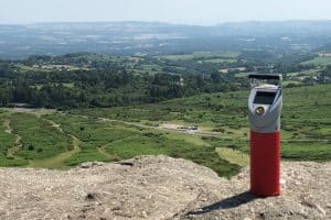
What is LiDAR Used For? February 2024 Airborne LiDAR – Gravity Gradiometry’s Most Under-Utilized Dataset Conducting LiDAR surveys is one of our service offerings at

What is a LiDAR Survey? What is a LiDAR survey? As a geophysical survey specialist, we get asked this question a lot. LiDAR is an

What are the differences between LiDAR and Radar surveys? At Metatek, we collaborate with various clients and partners in subsurface geophysics exploration. Amongst other methods,

What are the Different Types of Gravity Surveys? At Metatek, we specialise in different types of gravity surveys. When evaluating a project, we determine the

What Are Magnetotelluric Surveys? Magnetotelluric surveys are a geophysical exploration method using the Earth’s magnetic and electrical fields to measure the electrical resistivity of the

What are Magnetic Surveys? What are Magnetic Surveys? Magnetic surveys are a geophysical exploration technique used to measure and map variations in the Earth’s magnetic